
In 2025, a large-scale national project entitled “Foundations for the strategic planning of ecosystem services-based green infrastructure developments supported by regularly updated datasets” was launched in Hungary (ÖSZ-ZI, KEHOP_PLUSZ-3.2.2-24-2024-00002).
The aim of the project is to develop tools that integrate the protection of ecosystems, ecosystem services, and green infrastructure into sectoral policies, regional development, and land-use decision-making. The programme builds on up-to-date scientific data and supports the long-term restoration and sustainable functioning of Hungary’s ecosystems, thereby ensuring human well-being in the long term.
The project is coordinated by the Ministry of Agriculture with the participation of several professional partners, including the HUN-REN Centre for Ecological Research, the Lechner Knowledge Centre, the HUN-REN Agricultural Research Centre, the Budapest University of Technology and Economics, and the Hungarian State Treasury.
The project is implemented under the Széchenyi Plan Plus programme, with support from the European Union and co-financing from the Hungarian state. The project runs until 2028.


Working Groups
The project is based on nationwide data collection, database development, modelling, and creation of decision-supporting tools. The following working groups have started their activities:
- Sectoral integration
- Updating the national ecosystem base map
- Ecosystem condition assessment and mapping
- Ecosystem service assessment
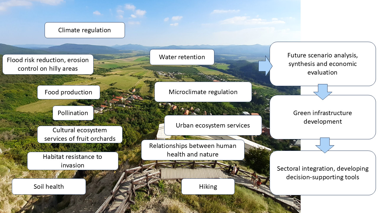
4.1 Food production
4.2 Climate regulation
4.3 Microclimate regulation
4.4 Urban ecosystem services
4.5 Pollination
4.6 Flood risk reduction, erosion mitigation on hilly areas
4.7 Water retention
4.8 Soil health
4.9 Habitat resistance to invasion
4.10 Relationships between human health and the state of nature
4.11 Hiking
4.12 Cultural ecosystem services of fruit orchards - Economic valuation of ecosystem services
- Future scenario analysis
- Integrated ecosystem service synthesis
- Green infrastructure condition and development
- Communication
- Coordination
Building on previous results
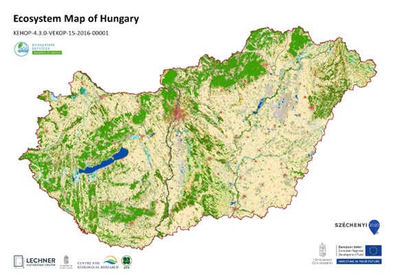
The project builds on an earlier programme entitled “Strategic assessments supporting the long-term conservation of natural values of community interest, as well as the national implementation of the EU Biodiversity Strategy to 2020” (KEHOP-4.3.0-VEKOP-15-2016-00001).
Within this programme the “National Ecosystem Service Mapping and Assessment” project (2016 – 2022) delivered the first nationwide ecosystem condition and ecosystem service assessments, as well as a comprehensive survey of green infrastructure. A public, downloadable ecosystem map with a spatial resolution of 20 × 20 metres was also produced.
Decision-support for the future
The project will produce new datasets, maps, and analyses to support both day-to-day decision-making and long-term strategic planning. These outputs help identify areas suitable for water retention, green corridor development, and pollinator-friendly habitats.
Scenario modelling will enable decision-makers to compare the impacts of current land-use practices with more nature-friendly alternatives. The project will provide practical tools to support green infrastructure development, the implementation of the nature restoration law, and adaptation to climate change.
A noticeable change in attitude
In recent years, there has been growing recognition that nature is the foundation of both society and the economy. If ecosystems fail to provide their services, everything from food production and healthcare to the functioning of the economy is put at risk.
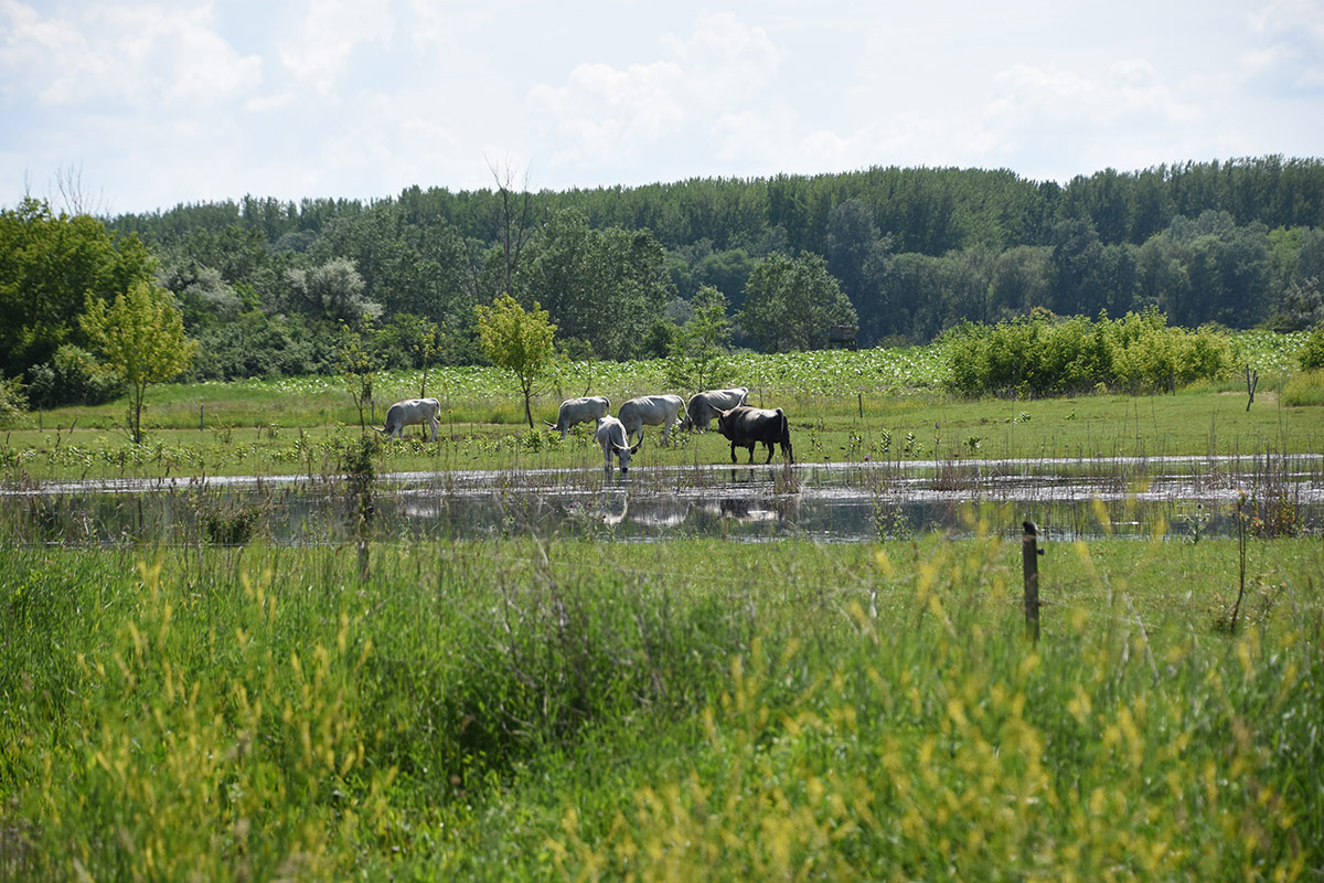
In Hungary, floods, inland water, and droughts can occur in the same area, even within a single year. A paradigm shift in water management has already taken place: the goal is no longer to drain water as quickly as possible, but to retain it in the landscape. In 2020, for example, within a KEHOP project of the Duna–Ipoly National Park Directorate, water was released into a drying wetland through a newly constructed lock and embankment on the Hajta Stream. In this way, water was returned to the landscape.
One of the largest working groups within the project focuses on water retention. This develops an integrated hydrological, ecological, and socio-economic model for the Tisza Valley. The hydrological model is being prepared by BME. The concept was presented at the 2nd Watershed Conference , organised under the auspices of the Sustainable Development Committee of the Parliament. The ecological model related to potential vegetation cover is being developed by the Centre for Ecological Research, while the socio-economic analyses are carried out by environmental management experts.
Water retention delivers not only ecological but also economic benefits: by improving groundwater management, the risk of drought and crop failure can be significantly reduced.
Collaboration
Broad collaboration within the project ensures that the perspectives and data of different sectors are taken into account, and that the results are translated into practical decision-support tools. The overarching goal is to achieve a systemic shift in perspective, where ecosystem services are recognised as real value in decision-making. If we allow nature to work, it directly contributes to human well-being.
Koncz, Péter
HUN-REN Centre for Ecological Research
Ecosystem Services Working Group Leader
koncz.peter@ecolres.hu
Budapest, 6 February 2026.