News

A bombcrater pond network demonstrates the importance of connectivity for aquatic biodiversity

Habitat fragmentation poses a growing global threat to our natural ecosystems, making it one of the greatest challenges in biodiversity conservation. Among the most vulnerable of these ecosystems are ponds, due to their small sizes and intricate networks. Ponds have experienced global declines in numbers and extent, making them a critical focus for conservation efforts. Once a pond loses its neighbors, it becomes isolated, which can lead to biodiversity decline. A new study, conducted in Hungary, sheds light on the importance of connectivity among ponds in these small-scaled habitat networks and its impact on the biodiversity of ponds.

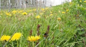
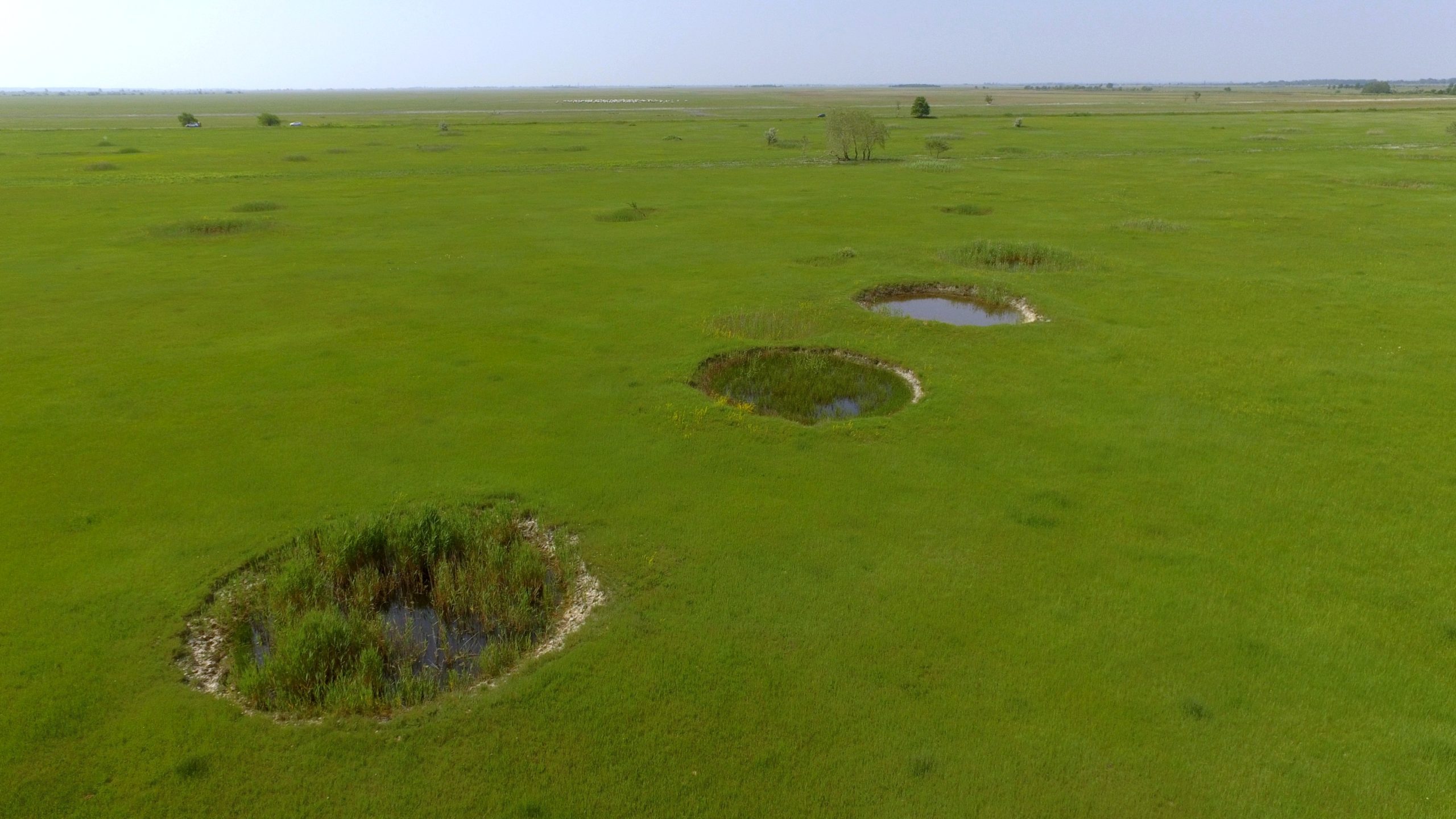
Situated in the heart of the Pannonian Plain on the interfluve of the Danube and Tisza rivers, Hungary’s Kiskunság region is a diverse landscape, encompassing a variety of aquatic and terrestrial habitats. From shallow lakes, soda pans, and swamps to dry and wet meadows, semi-arid sand dunes, and grasslands, the region supports a unique array of flora and fauna, including numerous rare and endemic species. Large parts of the region belong to the Kiskunság National Park and are parts of a UNESCO Biosphere reserve, while a number of aquatic habitats are listed under the Ramsar Convention. Here, a cluster of 112 bomb crater ponds form a network with ponds differing in their distances, and therefore their relative connectivity to their neighbors. This so-called ‘pondscape’ was likely created during World War II by mistargeted bombing on a sodic meadow of the nearby airport.

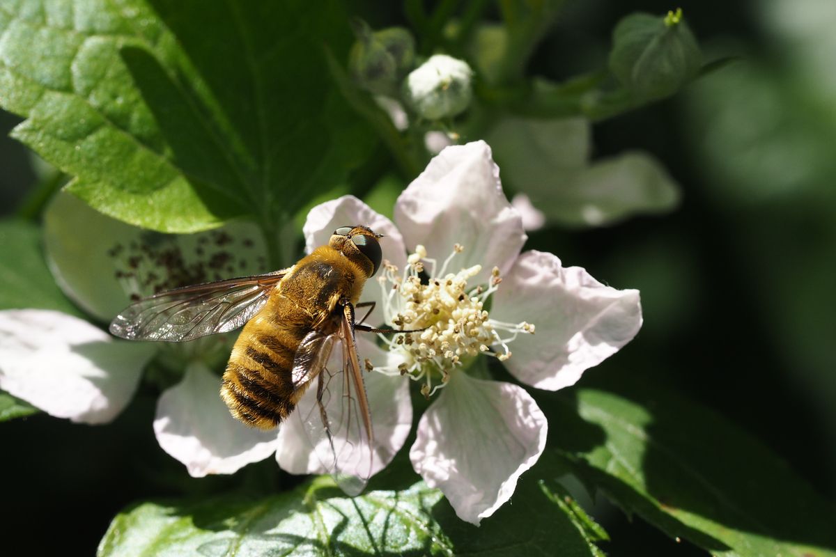
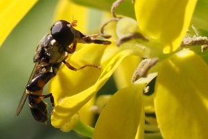
Bomb craters may be scars on our Earth and reminders of devastating history but these ponds are thriving with life and providing habitat for a range of aquatic species today. They hold sodic water mostly dominated by sodium carbonates and hydrocarbonates and they vary in environmental and morphological characteristics. The ponds host a variety of species, including Pannonian endemic fairy shrimp (Chirocephalus carnuntanus), protected amphibians, pond turtles, and a range of invertebrates such as dragonflies, mayflies, aquatic beetles, and microcrustaceans. Beside its importance for conservation, the pondscape offers a unique setting for investigating scientific questions in a natural laboratory. The ponds are small and easy to sample and they form a well-delineated network far from other waterbodies. Therefore, they represent an excellent model system to understand how pond networks sustain biodiversity, and form a metacommunity, i.e., multiple separate habitat patches potentially connected through the dispersing organisms.

The ponds are not physically connected by waterways thus the dispersal of organisms is expected to occur mainly via wind or by the active movement of the organisms. The prevailing assumption has been that such small-scaled habitat networks lack structuring by spatial processes, i.e. we cannot observe diversity gradients in the network due to differential dispersal rates because all organisms could potentially spread to all habitats.

However, the findings of a study carried out by researchers from HUN-REN Centre for Ecological Research in Hungary challenge this notion. The researchteam investigated the influence of both space, i.e., the arrangement of the habitat patches and the local environmental variables (e.g. water nutrient content, depth, salinity) on species richness and community composition in an international collaboration led by Barbara Barta. These were tested in a range of organism groups including the tiniest microscopic creatures to ones as large as amphibians. They are expected to respond differently to the environmental conditions and connectivity.

“The findings showed that besides environmental conditions which certainly play a significant role in shaping community composition, the spatial position of ponds in the network is also important, particularly for passively dispersing organism groups. These are the organisms (e.g. microbes, plankton) that rely on dispersal agents, such as wind to move them across the landscape. For these species, it is better to be in the centre of the network where their pond is surrounded by many other ponds from which conspecifics can easily arrive. This leads to higher diversity of these groups in the centre of the pondscape.” explains Barbara Barta, the lead author of this study. This discovery highlights the importance of the central-peripheral connectivity gradient within pond networks.

“These findings underscore the significance of studying and conserving ponds as integral components of a network, rather than as isolated entities. It is crucial that the network as a whole is protected with all the connections which ensures that the biodiversity is sustained. Understanding the impact of connectivity on biodiversity in fragmented ecosystems like ponds is vital for the preservation of these unique habitats.” summarises Barbara Barta.

Photo: Horváth Zsófia
A network of bombcrater ponds on a meadow in Apaj, Central Hungary

News

Project RestPoll: Restoring Pollinator habitats in Europe

RestPoll is a new project which aims to permanently restore and connect pollinator habitats in Europe. The project began in October 2023 and will run for 4 years. The project is led by the Chair of Nature Conservation and Landscape Ecology at the University of Freiburg. It aims to provide society with tools to reverse wild pollinator declines and to position Europe as a global leader in pollinator restoration.

Butterfly on twig, rename to: “Butterfly drinking plum juice” the butterfly is Vanessa atalanta – Felix Fornoff

Restoring pollinator habitats
To counteract the decline of pollinators and thus pollination services, it is important to restore their flowering and nesting habitats. This is important for biodiversity in general and for agricultural yields and food security.
RestPoll will, together with stakeholders ranging from individual land managers to governments, focus on measures and cross-sectoral approaches to restore pollinators and their services. Central to RestPoll is the establishment of a Europe-wide network of pollinator restoration case-study areas and Living Labs (LL), which are unique hubs for experimentation, demonstration, and mutual learning. Restoration activities in the eighteen case-study areas in fourteen European countries are partly already set up by stakeholders in cooperation with RestPoll researchers or vice versa.
The RestPoll consortium combines expertise from sixteen countries ranging from natural and social scientists, twenty-three research institutions, one NGO, three businesses, three ministries and one national park. Stakeholders along the food value chain will be engaged through newly developed participatory approaches at diverse social, ecological, and political scales. The project partners are a team of smart and passionate creatives.

Grass with yellow flowers rename to: “Bumblebee on spring flowers in vineyard” – Felix Fornoff

Kick-off in Lund, Sweden
The first meeting with all project partners will take place to kick-off the project and will be held on 28 and 29 November in Lund, Sweden. It is an opportunity for all project partners to discuss in person how to reach the ambitious project goals. The partners will share an overview of their work packages and certain topics related to data collection and policymaking will be discussed further. Alexandra-Maria Klein is coordinator of the project and currently a guest professor at the University of Lund. She is excited to launch the multi-actor restoration project.

“The project will support land-use transformation towards biodiversity-friendly and productive landscapes across Europe.”
– Alexandra-Maria Klein  

Pollinator on purple flower, rename to: “Hoverfly on purple flower” its Volucella bombylans on Thyme – Felix Fornoff

Launching RestPoll website
During the kick-off in Lund, the website for the project will also be launched: www.restpoll.eu. The website will stimulate knowledge exchange and include background information on the project and updates such as news, planned activities and milestones which have been reached.

This project has received funding from the European Union’s Horizon Europe Framework Programme under grant agreement No. 101082102.

Pollinator on yellow flower, that ok, it’s a hoverfly too (Syritta pipiens) – Felix Fornoff

News

A global running race – climate change and species range shifts

One of the effects of climate change is shifting the habitats of species. For example, warming is pushing upward the forest boundary in high mountains. The question is whether the species’ speed of spreading is fast enough to follow the suitable habitats. Dr. Beáta Oborny, a researcher from the Institute of Evolution at the Centre for Ecological Research and the Institute of Biology at the Eötvös Loránd University, together with her colleagues have developed a new method to investigate this. Their paper co-authored with Dániel Zimmermann was the editor’s choice in Ecography. (The editor’s choice is a paper highlighted as the most exciting and novel paper in the monthly journal issue.)

As our planet undergoes significant transformations due to climate change, habitats are being altered, appearing, disappearing, or changing in quality. Understanding the impact of these changes on the geographic distributions of species is of great significance. The shrinking ranges of protected organisms and the expanding ranges of noxious species, such as pests and pathogens, highlight the urgent need to monitor range movements precisely. However, this task poses challenges as the available observation time is often short compared to the pace of underlying population processes, making it difficult to distinguish between directional shifts and random fluctuations.

Addressing this challenge, a research team led by Dr. Beáta Oborny from Loránd Eötvös University and the Centre for Ecological Research in Budapest has developed a novel method to monitor range shifts. The team aimed to precisely and consistently delineate range edges, allowing for comparisons between different years, geographic locations, and species.
Delineating range edges accurately is a non-trivial task as they often exhibit complex patterns. Occupied peninsulas are interspersed with unoccupied bays, and isolated occurrences dot the landscape. While traditional methods rely on the outermost occurrences of a species, Oborny and her colleagues propose a different approach. They suggest marking the range edge at the boundary between connected and fragmented occurrences, known as the “hull.” By marking the average position of the hull, the “connectivity limit,” over time, the researchers offer a statistically more reliable method. This region has a higher population density and exhibits smaller fluctuations, enhancing the robustness of the approach.

An upper limit of Dwarf mountain pine (Pinus mugo) in the low Tatra Mountains, Slovakia. The inset shows a snapshot from simulated population dynamics. Dark/light green shows the connected/fragmented occurrence of the species. The hull is marked by red.
Photo: Courtesy of Konrád Lájer simulated image: Beáta Oborny

Oborny and her colleagues delved into the pattern-generating mechanisms using spatially explicit models. Unlike previous approaches based on general spatial statistical methods, their novel approach capitalizes on knowledge about the mechanisms governing the emergence of these patterns: birth, dispersal, and death within populations. Through computer simulations along environmental gradients (e.g., hillsides), the team explored the connectivity limits of different kinds of species. Remarkably, they discovered that the hull displayed a robust fractal structure with a dimension of 7/4. Further investigations conducted by Beáta Oborny and Dániel Zimmermann confirmed that this fractal structure remained consistent regardless of whether the range was rapidly advancing or retreating compared to the generation time. Notably, the method demonstrated particular robustness in the retreating (trailing) edge of species ranges. These findings highlight the applicability of the connectivity limit in tracking range shifts across diverse geographic scenarios, enabling a global perspective on these changes. For instance, the method allows for the comparison of treelines in different mountains, even when composed of different species, utilizing universal scaling laws.

The universal features uncovered in this study find their explanation in percolation theory, a field of research in statistical physics. This exemplifies the power of knowledge transfer between seemingly disparate scientific disciplines. The insights gained from these investigations deepen our understanding of the intricate relationship between environmental changes and species distributions. As scientists continue to refine and validate this method, it holds the potential to contribute to more robust assessments of biodiversity shifts and inform effective conservation strategies.

Image: An upper limit of Dwarf mountain pine (Pinus mugo) in the low Tatra Mountains, Slovakia. The inset shows a snapshot from simulated population dynamics. Dark/light green shows the connected/fragmented occurrence of the species. The hull is marked by red.
Photo: Courtesy of Konrád Lájer simulated image: Beáta Oborny